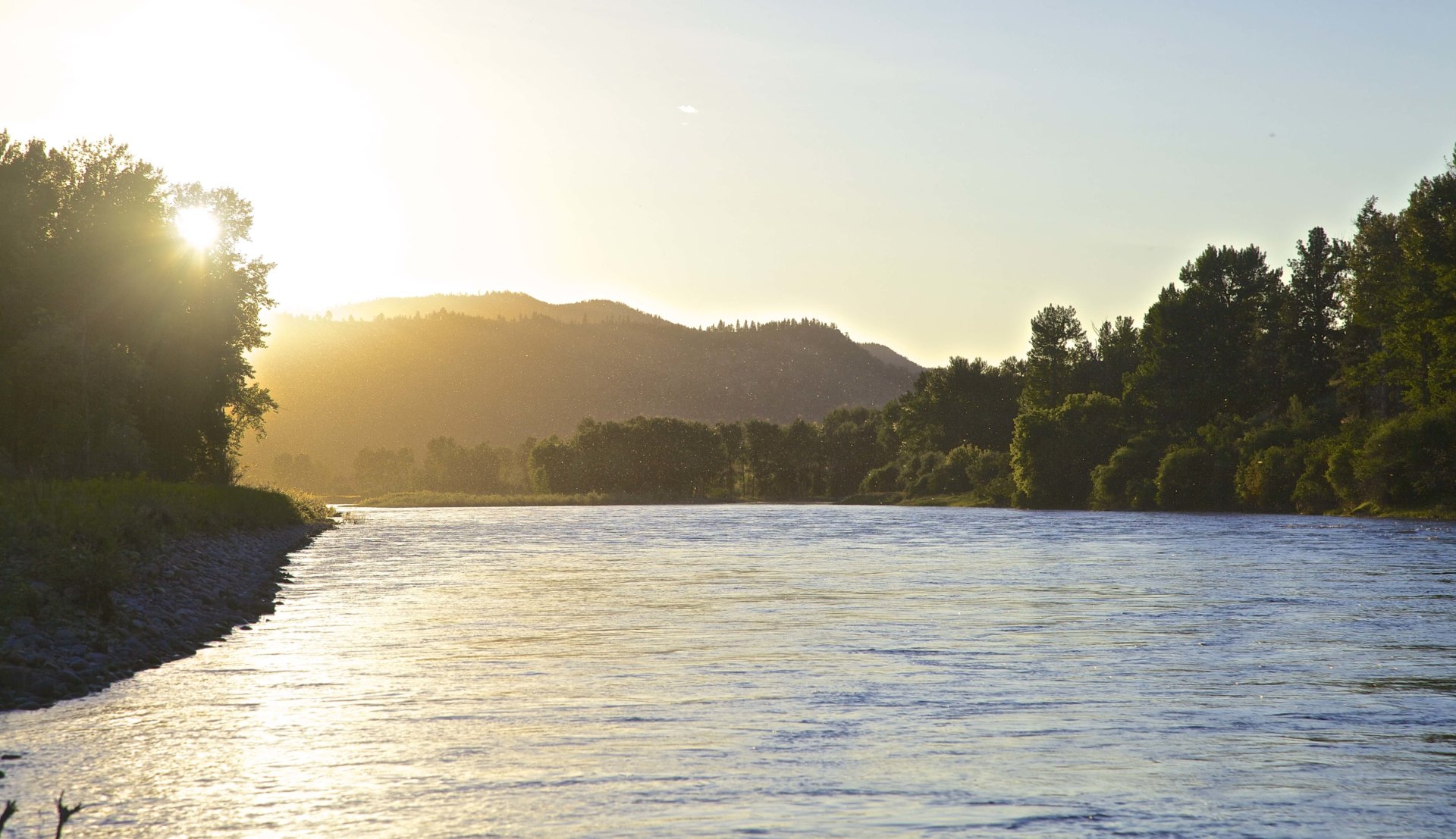
WHAT’S THE FLOW?
You hear it constantly this time of year. “What’s the flow at Bell Crossing on the Bitterroot River?” “Oh crap, it came up 300cfs!” “Hey, it only came up 300 cfs.” What does it all mean? Where are these people getting this information?
It all starts at the USGS website, Streamflows for Montana. This is the URL https://waterdata.usgs.gov/mt/nwis/current?type=flow .You can also find this information at The Missoulian Angler Fly Shop’s fishing report, if that’s faster. That’s where you find the information on river flow. This will allow you to understand in much greater detail the information that’s available from this website, and how to interpret it.
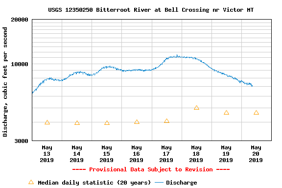
Look at the screen shot for Bell Crossing on the Bitterroot River. You can see the flow, represented by the blue line and measured in cfs (cubic Feet per Second), went up dramatically (spiked) four days ago, and is now dropping quickly. Notice the graph rows are NOT equal in thickness. So in real height, while the spike only went up a ½ inch, it covered almost 2500cfs. The bottom row of the graph, indicating 1000cfs, is actually wider than the 3,000cfs found at the top of the graph. I’m sure there’s a reason for that, but just be aware the row sizes vary, and you need to check the numeric value found on the left hand side to be accurate, when checking flow.
This concept is also critical. All flow information is contextual. Five days ago, the river was about 6500cfs, which is above average flow. The hollow triangle designates the average flow on this date for the history of this gaging station. You can see the Bitterroot is above it’s historical average. A spike in the flows, as seen on May 17 when the river rose 2,000cfs in 12 hours, will bring a lot of debris into the river, coloring the water and making floating and wading a dicey proposition. But as the river drops, the debris begins to beach itself, and the water will start to clear. Maybe not enough before the next spike, but it’s getting clearer!
Let’s talk about the 300cfs reference. Again, it’s all contextual. If the Bitterroot River at Bell Crossing rises 300 cfs in the next 12 hours, it would be less than 5% of the flow, and would probably not affect the fishing very much. But if Flint Creek, which normally runs at 125cfs, jumps 300cfs, that’s a big spike of 200% more flow. So on one river, 300cfs is not a big deal. On another river, 300cfs is a very big deal. Which is why you need to know a bit about the river being discussed! To make it a bit simpler, the bigger the river, the more water it takes to spike. Smaller rivers take less water to dramatically effect flows. It’s also why you always view a week’s worth of data when looking at a specific gaging station on the USGS site, to make sure that context is immediately visible.
With a little practice, and regular checking, you can learn to read the stream flows as they relate to fishing. Of course it’s no substitute for eyes on, but it’s a very useful tool to have. It’s very easy to drive over the Madison Street Bridge right now and think there’s no fishing to be found in the entire region. But the Clark Fork River is the main drainage for the area, which means it’s often the last to color up, and the last to clear. So while downtown Missoula’s flows may be high and poor for fishing, you may find, with a little internet sleuthing, that other rivers in western Montana are dropping, clearing and most importantly, fishing!