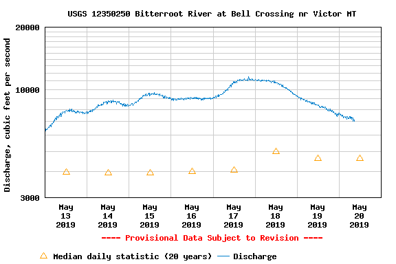
When the rivers are high and brown, there’s a feeling that goes through the Missoula fly fishing community. It’s a combination of frustration, annoyance and a little bit of optimism. If only just, if I just did this, I would find clear water. The eternal optimism of the Missoula fly fisher comes through in the month of May. This optimism is always tempered by a trip across any bridge in downtown Missoula. Before they re-did the Russell Street Bridge, you could feel the bridge vibrate as the brown water raced under it. Not the first thing you look for in a place to fish!
But there is clear water, you simply have to decide you’re going to find it. Lets start at the wrong end of the spectrum, and move forward from there.
The worst place to find clear water in Missoula in May is below Kelly Island. Within 26 miles of Kelly Island, the Blackfoot River, Rock Creek and the Bitterroot River all pour into the Clark Fork River. The entire sum total of all the mud, logs, trees, and anything else that found its way to the edge of the river is coming downstream, and the lower Clark Fork is the catch all for everything. The lower Clark is pretty much the last place to search for clear water.
And from there, we start to follow the general wisdom of clear water in rivers. The further upstream you go, the clearer the water gets. It only makes sense. The higher you go in the water shed, the less chance there is for all the discoloration attendant to run-off to enter the water. So with the Clark Fork in mind, the best place to find clear water is the Warm Springs area. It’s as far upriver as you can go, and the water will be as clear as you can find in May. The same holds for all our local rivers. East and west Forks of the Bitterroot, the Upper Blackfoot and Rock Creek- the farther up river you travel, the clearer the water will be.
On the 3rd Saturday in May, the upper reaches of the rivers become so much more accessible as the tributaries open. The same rules apply to the tribs as do the rivers. The further up you go, the clearer they get. But many tribs are higher gradient, and high gradient streams hold less silt, and run clearer. Tribs are also smaller (Duh) and they have less junk floating down them. The higher sections of the tributaries offer instantaneous access to clearer water.
You’ve had to read this far to get to the easiest answers. If you’re looking for clear running water, the Missouri River is the answer. With the dam at Wolf Creek, the Missouri River is a tailwater. The bottom release water is almost completely unaffected by the mud pouring into the water behind the dam. Comes in dirty, comes out clear! There are two things to take into consideration when thinking of the Missouri. The first is its size. The water may be clear, but the dam can only hold so much water. The water levels in the Missouri go up during run-off, just as if it was a freestone river. The wading access isn’t always ideal. Given an option, the Missouri is a river better floated in May. Additionally, while the Missouri itself isn’t affected by runoff, the larger tributaries to the Missouri are. At the peak of run-off, the Missouri is really only fishable from the dam to where the Dearborn comes in. The Dearborn will be brown and high, and as soon as it enters the Missouri, the entire river clouds up and the fishing slows way down. Keep that in mind as you head to the Missouri in May.
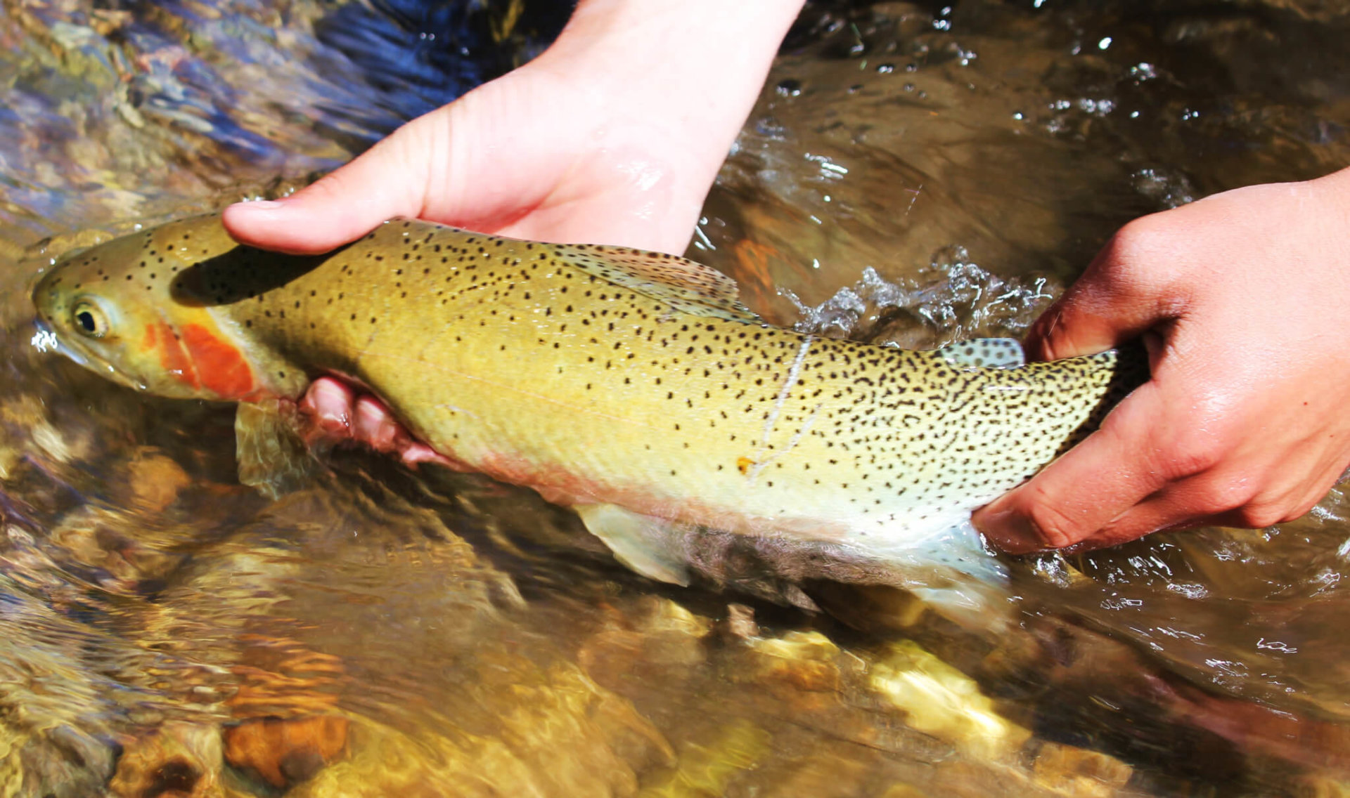
In such a river-centric city, it’s easy to overlook the still water fly fishing around Missoula. It’s good all year round, but most anglers are focusing on the rivers most of the time. In May, many of the higher altitude lakes are icing off, and the fish are looking to feed after a long, cold winter. The ice out can be an amazing time in Missoula, with Brown’s Lake, Beavertail reservoir and Harpers’ Lake coming rapidly to mind as some of the best Missoula still water fisheries in May. And those are just the lakes we talk about. The mountains around Missoula are full of lakes- pick up a gazetteer and you’ll find hundreds. A nice hike in the mountains, and the possibilities of wild WestSlope Cutthroats- it’s a great spring day.
And we’re going to say it, but kind of in a whisper. There are bass in Montana. Big ones. Feisty and ready to eat in the lakes around Missoula. As the Spring warms the waters, the bass start looking to the surface. There’s very little more exciting than watching a Largemouth bass crush a surface popper as you rip it through cover. The blowup is something to be seen. And where you find bass you often find pike, which are also on the move as the warm weather starts to heat up the water. Some fine bass fishing is found in Upsata Lake, Nine Pipes Reservoir and Kicking Horse Reservoir. Remember that Nine Pipes and kicking Horse are on the Flathead reservation, so a separate license is needed to fish those waters. Nine Pipes is also a Migratory Bird Sanctuary, so there are specific rules that apply to fishing there. Consult the regulations before heading up there to fish.
We know, every time you cross the Clark Fork River in Missoula the brown gets you down. But the rivers aren’t off color everywhere. Nor are the abundant high mountain lakes and lower reservoirs. The tribs will soon be open, and the fishing is going to be better than our limited city vision will lead us to believe. It’s just like our local ski slope. The crafty veterans can’t wait for the snow to melt in town, because many skiers think, “Oh well, no snow.” Not in the mountains, and the crowds go way down. Same with the brown Clark Fork, we see off color and think no fishing. But with a little thought, you can find fish through the month of May and the first two weeks of June. The fishing is there, you just have to widen your gaze just a bit.